 Русский
 English
Geological history
The first stage of folding and mountain formation, leading to the creation of complex folded structures, began at the late Paleogene. The next stage was marked mainly by block vertical displacements and periodic intensification of faulting tectonic.
Before the upper Neogene the land was located far west of the modern Black Sea coast. River flows by broad river valleys beautifully took place in the northern direction.
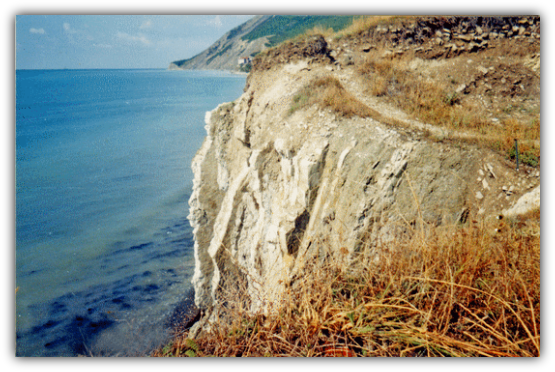
A radical restructuring of the tectonic relief of the Anapa‒Novorossiysk area took place about 4 million years ago. Moreover, the predominant factor in this restructuring were not the raising of the land associated with the uplift of the Caucasus, and by lowering of the blocks bordering the Black Sea depression developing as a result of the earthquake about 12 points. This led to the formation of Tsemes Bay and a significant lowering of the land west of the Abrau Peninsula. In the result the modern coastline of the sea had been formed.
It is known that depending on the distance from the epicenter, the destructive force of earthquakes decreases. The results of the study of tectonic processes suggest that the coastal zone from Anapa to Myskhako several kilometers wide in the historical past were possible 8-point earthquakes, and on the rest of the continental territory ‒ ones 7-point.
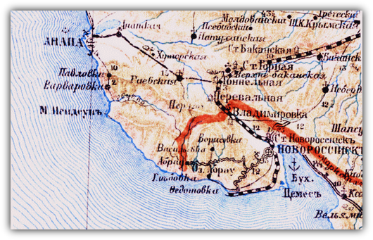
The peninsula has a long coastline and many archaeological sites located on the coast. We have examined location of sites and monuments in the Myskhako Lobanova Schel’. The most conservative estimates indicate that coast retreated (was destroyed by the sea) at least 200‒400 m.
(Ol’ga E. Vyazkova).